- Hotels
- Rent-A-Car
- Routs
Government of Huíla plans to launch a new Tourist Map.
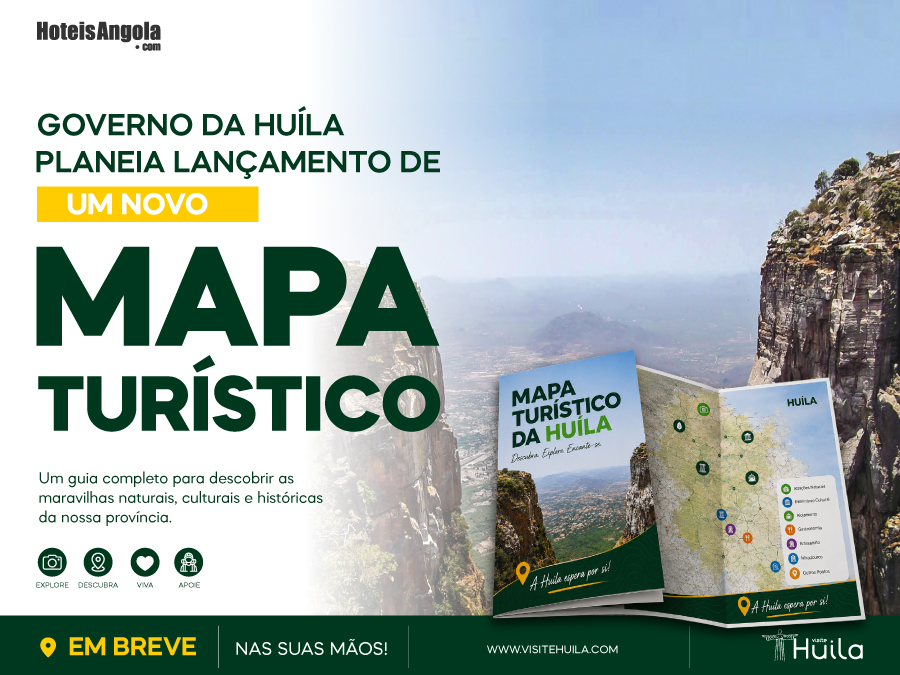
The first, a printed version, will allow visitors to quickly consult the province's main points of interest, integrating QR codes that will provide access to updated digital content.
At the same time, a digital version will also be made available, more interactive and dynamic, designed to provide users with a more comprehensive experience through Huíla's online tourism support platforms.
According to the Provincial Director for Culture and Tourism, Tiago Pinto, the project is part of the strategy that the local Government is implementing to consolidate Huíla as one of Angola's leading tourist destinations.
He added that in recent years, the province has experienced strong momentum in promoting its natural, cultural and historical heritage, establishing itself as a national benchmark in the enhancement and promotion of its tourism resources.
A Visitar na Provincia da Huila
Lubango
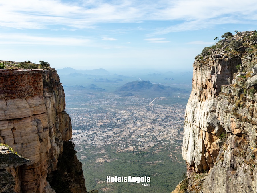
Tundavala Rift
The Tundavala Rift is a huge chasm of around 1200 m located in Serra da Leba, 18 km from Lubango, in the province of Huíla, in Angola.

Chibia
Hungueria Waterfall
The Hunguéria Waterfall is like a hidden treasure where you can only reach the right way.

Humpata
Old Humpata Bridge
The structure is located at the entrance to the village of Humpata, very close to the old colonial road that connected the Huíla plateau to other towns in the region.
Lubango
Aloe Palmiformis
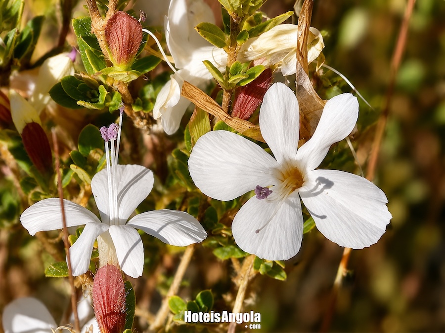
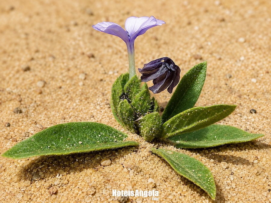
The name Barleria rupicola literally means
Lubango
Aloe Palmiformis
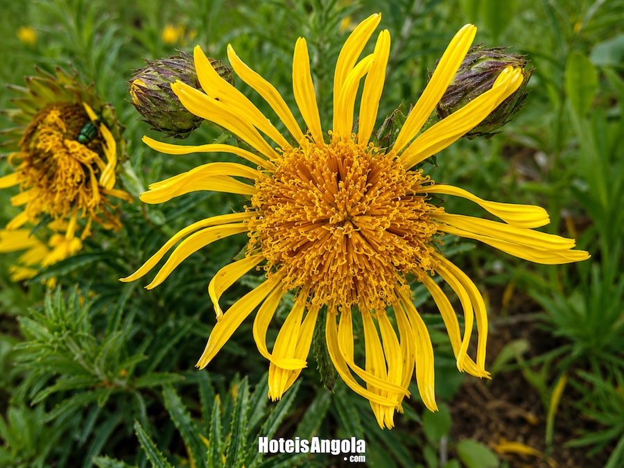
Berkheya welwitschii is a herbaceous plant endemic to Angola, easily recognized by its large yellow flowers and thorny leaves.
Lubango
Aloe Palmiformis
Berkheya welwitschii is a herbaceous plant endemic to Angola, easily recognized by its large yellow flowers and thorny leaves.
Lubango
Aloe Palmiformis
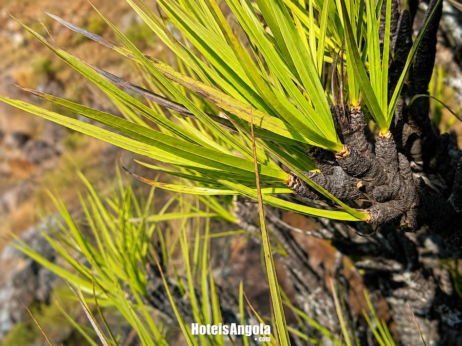
Xerophyta capillaris is a plant extraordinarily adapted to the drier environments of Serra da Chela
Lubango
Aloe Palmiformis
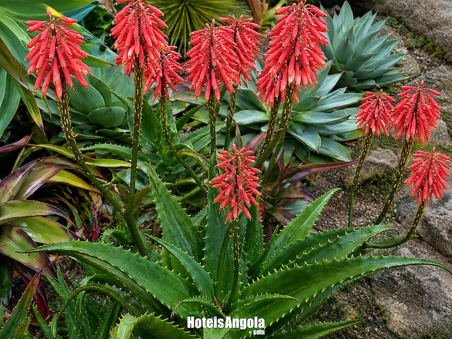
Aloe palmiformis is a succulent plant endemic to Angola and one of the most emblematic species of Serra da Chela.

Quilengues
Cutembo River Falls
Located in the municipality of Quilengues, they appear as one of those little-known scenes in Angola that impress with the combination of wild nature, silence and mountainous landscapes.

Lubango
Tundavala Dam
It is a small reservoir located close to the famous Tundavala Rift, in the province of Huíla.

Lubango
Tundavala Waterfall
The waterfall is located in a mountainous landscape marked by the rock formations of Tundavala and the typical vegetation of the Huíla plateau.

Matala
Bicuar National Park
The Bicuar National Park, was established as a game reserve in 1938 and transformed into a national park in 1964 with the aim of preserving the existing species in the area among which they stand out: elephants, lions, sable, buffalo etc. It has an extension of 1,200Km² and is limited by the Chicusse, Cunene, Cusso, Cussava and Chissanda rivers. It is one of the promising tourist reserves in southern Angola, due to its privileged geographical situation that has the natural conditions it offers, from the wonderful landscapes to the beautiful specimens of wild animals.

Matala
Cuto Zone
It is a destination of great natural and cultural value, known for its peaceful landscapes, mountains, vegetation typical of the southern region of Angola and welcoming rural environment.

Matala
Bamba-Micosse River
The place is considered a natural and cultural tourist spot, because it combines the beauty of the landscape with history and tradition.

Matala
Matala Dam
It is located east of the Municipality and north of the Province towards Cuando Cubango, and is more than two kilometers long.
Humpata
ONDIMBA Caves
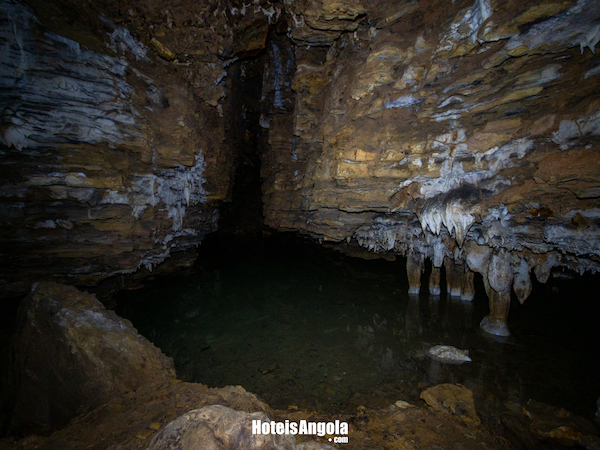
At the entrance to the cave, only water flows from a peaceful spring at the bottom of the cave. The vestibule of the cave known as the “room of the lakes” (Timóteo1974. Pag.54) is surprising. Inside we can see majestic stalactites in its vault, some
Lubango
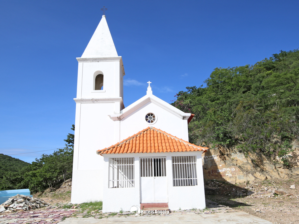
Chapel of Our Lady of Mount
The Chapel of Our Lady of Mount is along with the Statue of Christ the King, the great exiles of the city of Lubango.
Lubango
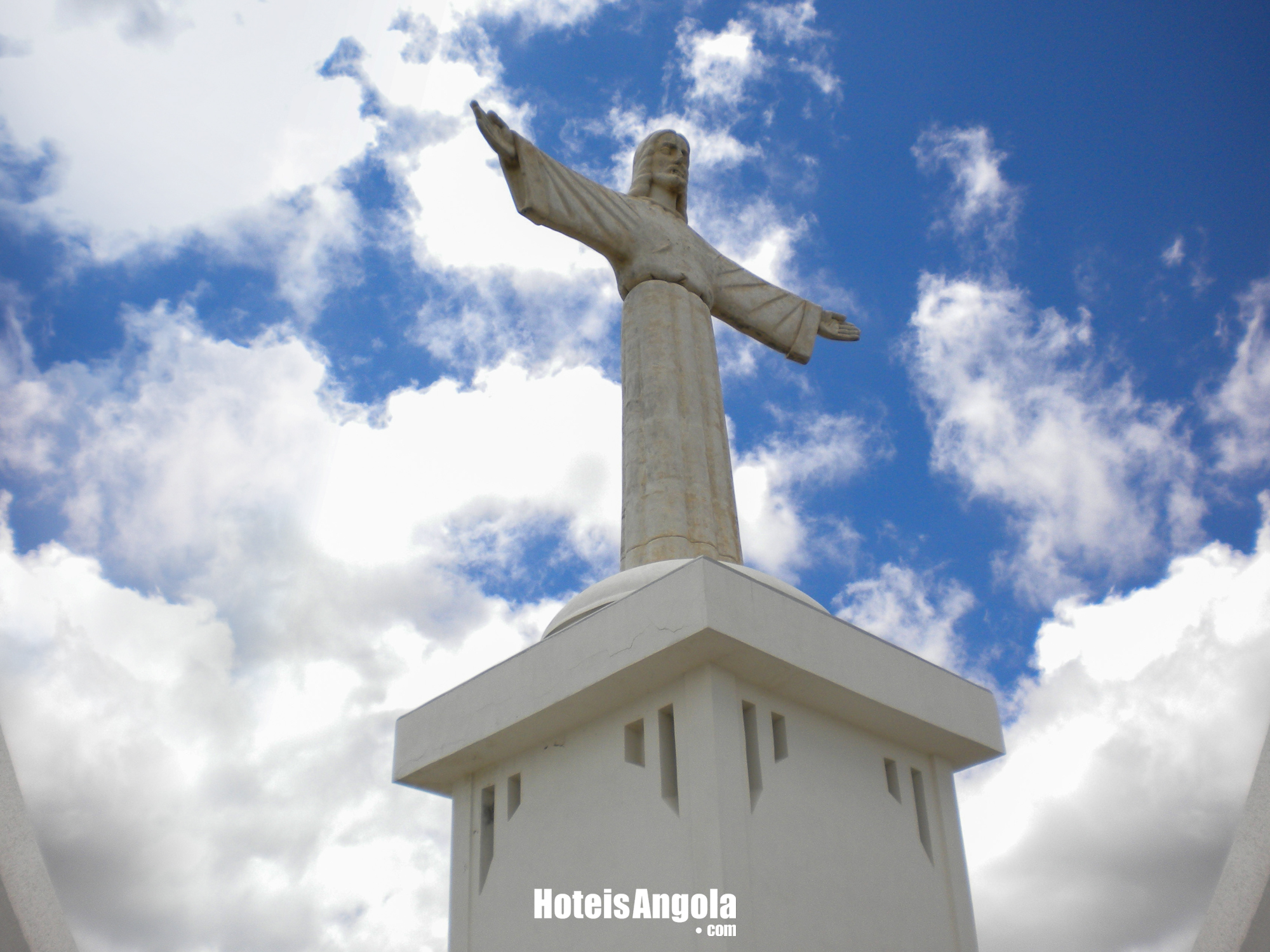
CHRIST THE KING Monument
It was built in 1957, based on the similarity that the City of Sá da Bandeira had with the headquarters of the island of Madeira, where the first contingents of settlers mandated by the Portuguese Government came from between 1884/85.

Lubango
Huíla Regional Museum
The Huíla Regional Museum is a public, permanent, scientific, non-profit institution, at the service of society and its development, open to the public that acquires, preserves, researches, disseminates and exhibits material testimonies
Kuvango
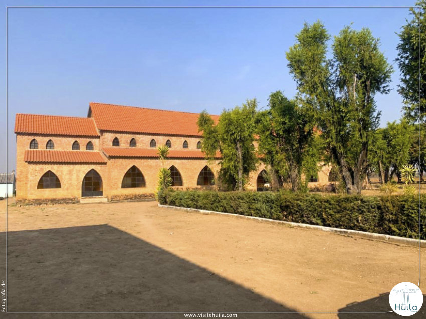
Cuvango Catholic Mission
The first rehabilitation of the Mission took place in the period 2007/2011, with the Archbishop of Lubango, Dom Gabriel Mbilingi, inaugurating this phase of renovation in September 2011.
He emphasized that throughout the current year, several initiatives have already been carried out with the main stakeholders in the tourism value chain, including travel agencies, tour guides, car rental companies, accommodation establishments, restaurants and other partners.
According to the Provincial Director, these initiatives have strengthened coordination among the various operators, promoted dialogue and created new opportunities for collaboration in the sustainable development of provincial tourism.
Tiago Pinto pointed out that another important milestone of the strategy was the implementation of training activities for municipal technicians, carried out within the framework of the support provided by the United Nations Development Programme (UNDP).
According to the interviewee, the training focused on inventory methodologies, field surveys and the documentation of tourism heritage, equipping municipalities with technical tools that enable them to systematically identify, catalogue and update their tourism resources.
Huíla surrounding area
- from kz 105,000Hotel Serra da Chela
- from kz 60,000Kimbo do soba
- from kz 101,440Pululukwa Resort
- from kz 35,000Hospedaria S&I Freitas
- from kz 52,500Hotel Vip Huila
- from kz 60,000Hotel Chik Chik Lubango
- from kz 42,265Zoom`s Lodge
- from kz 60,000Vila Mara Flats
- from kz 55,000Hotel Yona Lubango
- from kz 22,500Pousada de Quilengues
- from kz 105,000Mumba Lodge
- from kz 40,000Mask Hotel
- from kz 33,000Huíla Park Residence
Tiago Pinto also stated that the future tourism map therefore represents another stage in the process of modernizing Huíla's tourism information, establishing a direct connection between the printed format and digital platforms, where visitors will be able to find updated content, itineraries, useful contacts, the location of the main attractions and other relevant information for planning their trip.
"The Provincial Office for Culture and Tourism will continue to implement this strategy in close collaboration with public institutions, private partners and tourism operators, with new promotional, capacity-building and awareness initiatives planned over the coming months.", he said.
The province already has a tourism map created in 2004, which is now considered outdated in the current context.
Rent-a-Car:

Support Line
 WhatsApp
 Telephone
 Email
Email
Available every day from 8:00 AM to 10:00 PM. Allows you to clarify doubts, support reservations, and guide you in choosing the best accommodation and tourist services.